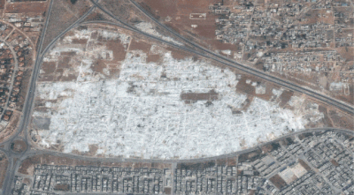
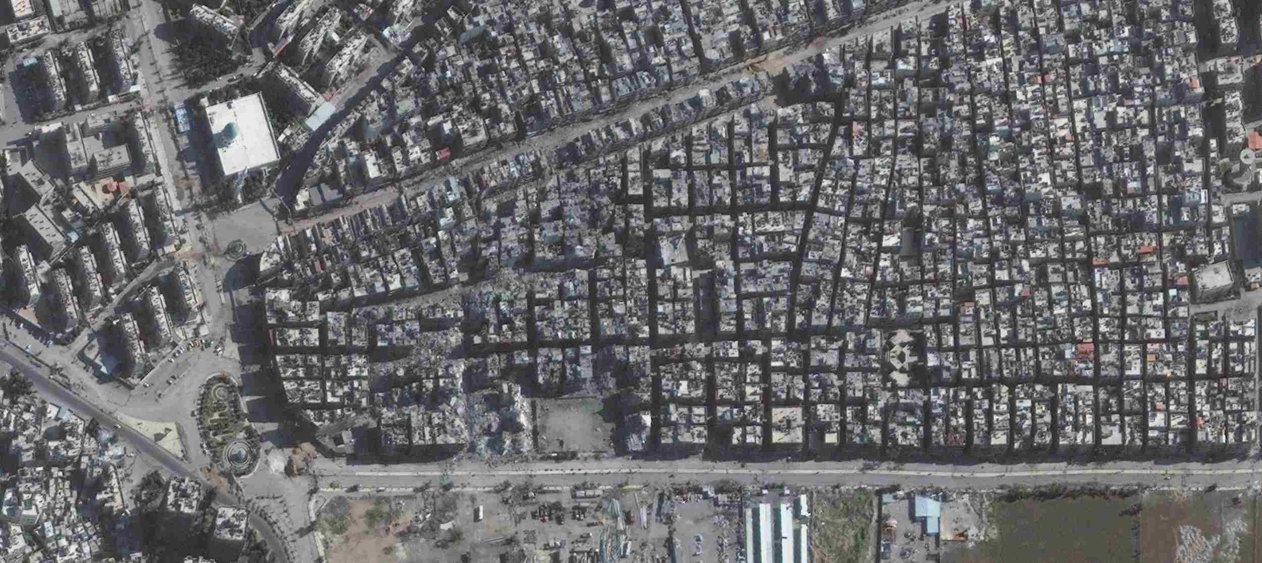
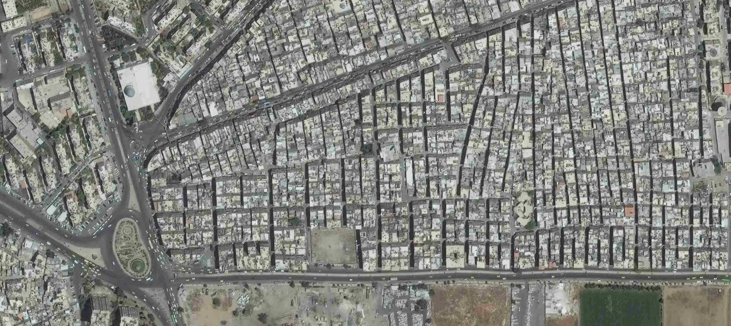
Yarmouk
The UN's UNOSAT satellite imagery unit has provided these before and after photos of Yarmouk camp for Palestinians in southern Damascus. They report: "Yarmouk Camp is a district of Damascus and it is considered as an unofficial refugee camp that shelters more than 18.000 Palestinian refugees. UNOSAT has performed security analysis to monitor the situation in the camp over the Syria conflict. Imagery from 2014 [compared to 2011] shows Yarmouk as besieged, with numerous roadblocks and security controls along strategic roads and controlling access to the district. Moreover, damage from bombing and shelling has reduced multiple buildings in Yarmouk to rubble."
Hama
UN satellite team UNOSAT has released before and after pictures showing the obliteration of a neighbourhood of the city of Hama. Their report says: "These images depict the results of the demolitions occurring in the Masaa Al Arbaeen district of Hama between 27 September and 23 October 2012. Residents living in this area were perceived as sympathizing with the opposition. As of 26 November 2012 the whole of the district is demolished, affecting a total of 3,256 buildings that were reduced to rubble."
Deir ez Zour
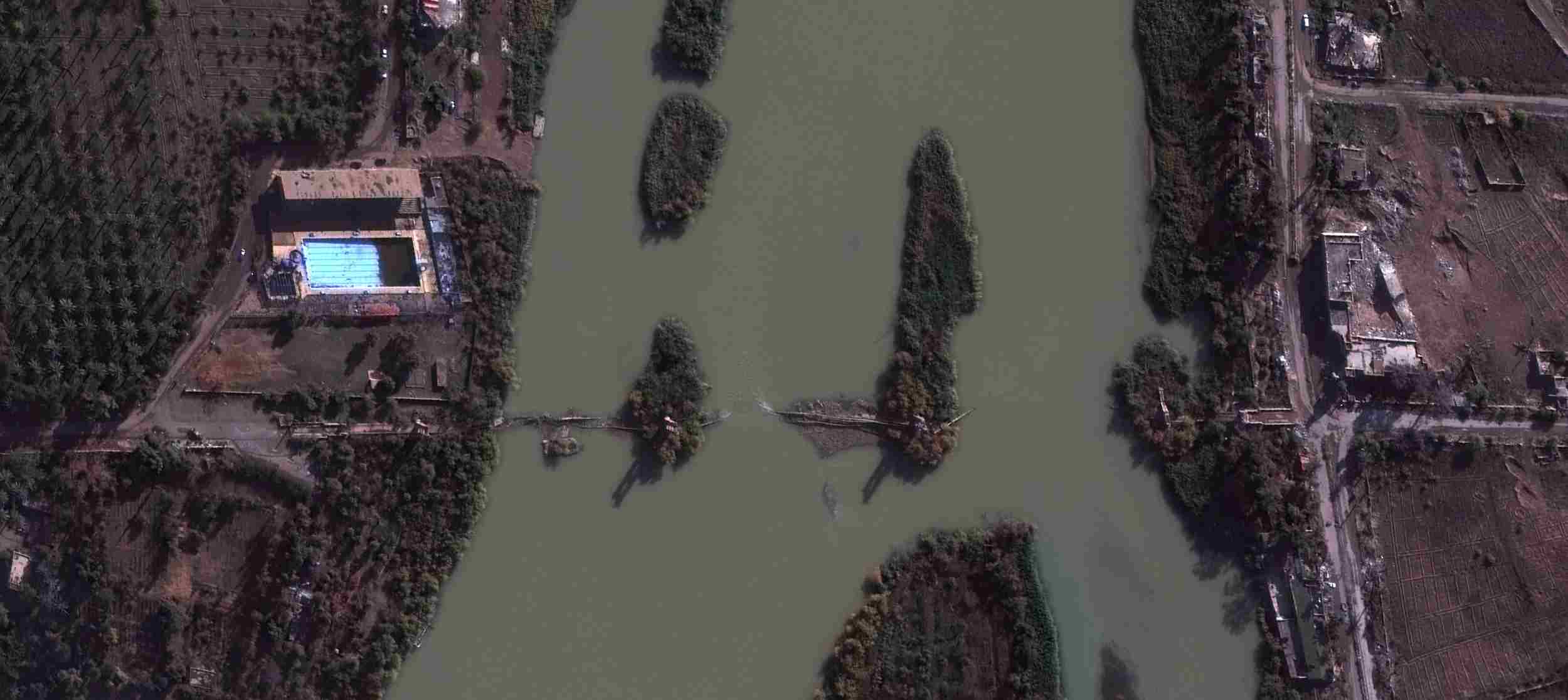
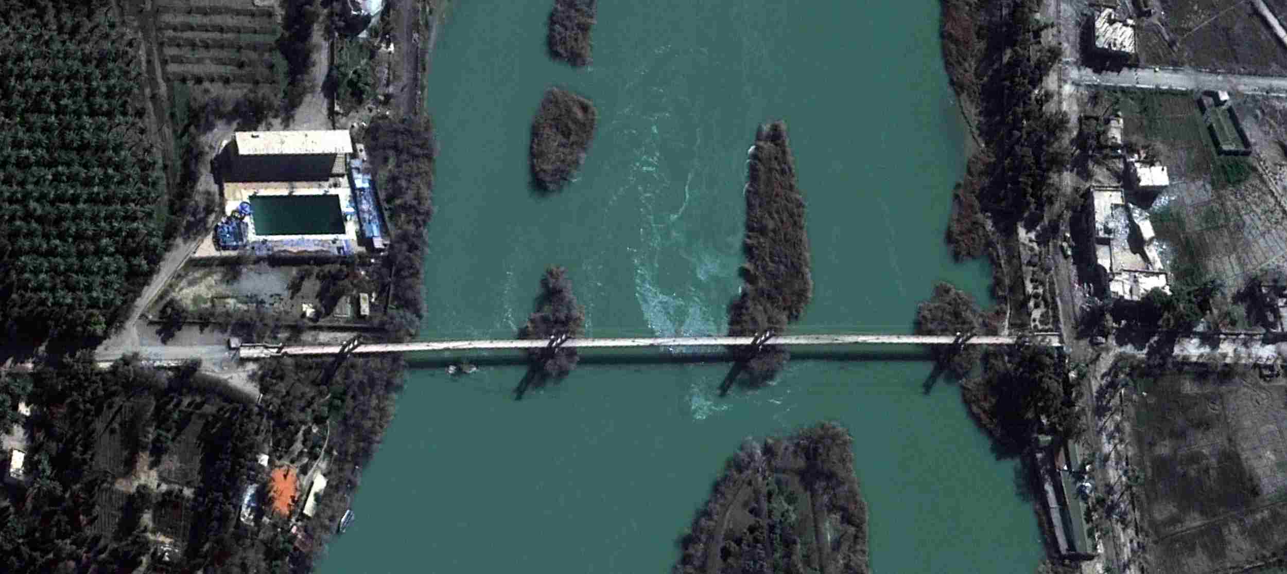
UNOSAT caption: "On the 2nd of May 2013 in Deir Ez Zor City, the historic pedestrian suspended bridge across the Euphrates River was reported to be completely destroyed by government shelling. Imagery from 25 November 2014 confirmed the destruction of the bridge, which severed communication to the neighborhood of Hasakeh and cut off access to an estimated 50,000 people."
Aleppo Citadel

UNOSAT reports: "Multiple historical sites destroyed as seen in the upper left section of the image, such as the Carlton hotel, where craters are present. Other damaged locations include the Great Umayd Mosque in the lower right corner of the image. Minaret of the Great Mosque has been destroyed, in addition to severe damages to the wall and courtyard."